You can only play so much tennis or golf. And hanging around the pool? It can get really boring.
So when I visit the Palm Springs area, I head into the hills for some hiking. There are plenty of trails, from easy to strenuous, in this corner of the Sonoran Desert.
Trails covering more than 1,250 miles lie within a 60-mile radius of Palm Springs, said Nancy Bone, a member of the Coachella Valley Hiking Club and an outings leader, and the variety of topography and plant life make it one of the country’s best hiking destinations.
Layer in cooler fall and winter temperatures and it’s pretty close to hiking heaven.
To prepare for my visit last year, I bought Philip Ferranti’s book “140 Great Hikes In and Near Palm Springs,” then got half a dozen recommendations from easy to challenging from Melissa Schmidt, a Backroads guide, and Michael Sanchez, who works at La Quinta Resort.
“Many of the people who come to the Palm Springs area are active and want to be out and about,” said Schmidt, whose Berkeley-based company leads hiking tours in the area from October through March.
Stone pools

My favorite stroll was in Indian Canyons, the ancestral home of the Agua Caliente Band of Cahuilla Indians,
The lush canyons were home to the Cahuilla people in centuries past, and you can see remnants of their house pits, irrigation ditches, dams and rock art.
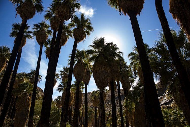
The canyons also are filled with towering, shaggy California fan palms and creeks that flow almost year-round with snow melt from the looming San Jacinto Mountains.
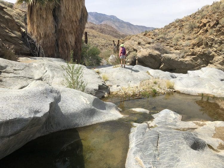
I chose the Palm Canyon Trail to the Stone Pools, a six-mile out-and-back jaunt that had a moderate 800-foot elevation gain.
Once you leave the almost jungle-like stream bed and ascend to the desert plateaus, you’ll encounter water-sculpted rock gorges and cliffs that make great spots for a picnic. Other hikes in the same area lead to the Andreas, Fern and Murray canyons.
Info: Indian Canyons, 38500 S. Palm Canyon Drive, Palm Springs; (760) 323-6018. Admission $9 for adults, $7 for students and 62 and older, and $5 for children 6 to 12. Open 8 a.m. to 5 p.m. daily Oct. 1 to July 4 and Fridays-Sundays from July 5 to Sept. 30. Buy your pass at the trading post, 38520 S. Palm Canyon Drive. No animals.

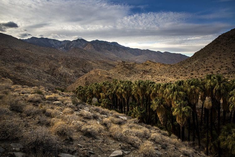
The Coachella Valley Preserve is perched on the San Andreas Fault. Its hydrogeology forces water to seep to the desert’s surface, where it feeds more than 1,200 California fan palms and critters such as the fringe-toed lizard.
Three of the most popular hikes in the 17,000-acre preserve are the Pushwalla Palms, the Willis Palms and the McCallum trails. All are easy to moderate because much of the terrain is relatively flat.
The Pushwalla hike with a gain of 944 feet is the most difficult. The 5.6-mile loop leads to the Pushwalla Palms Oasis. The Willis Palms hike is four miles, and the McCallum trail is a mere 1.7 miles and a good choice for families with small children.
Info: Coachella Valley Preserve, 29200 Thousand Palms Canyon Road, Thousand Palms; (760) 353-1234. Open 7 a.m. to 5 p.m. through April 30; 6 a.m.-8 p.m. from May through September. Admission is free but donations are accepted. Trained service dogs only.
More hikes
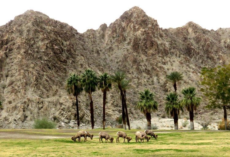
La Quinta Cove, a neighborhood off Calle Tecate at the southern edge of La Quinta, is the trailhead for several footpaths that lead to views of the Salton Sea and the Santa Rosa Mountains. You may even encounter a bighorn sheep or two. A moderate trail goes from the Cove to Lake Cahuilla, covering 6.6 miles round trip with a gain of 915 feet.
For something considerably more difficult, try the 12-mile Boo Hoff Trail, named for a horseman who helped create many trails in the area. It starts in a wash and climbs 2,200 feet to a lookout,passing cholla cactuses and colorful ocotillo along the way. It then loops back along Devil’s Canyon to the Cove.
The Coachella Valley Preserve is perched on the San Andreas Fault. Its hydrogeology forces water to seep to the desert’s surface, where it feeds more than 1,200 California fan palms and critters such as the fringe-toed lizard.

Info: Hiking La Quinta. To reach the trailhead, take California 111 to La Quinta. Turn south at Washington Street. Continue to Eisenhower Drive, turn right and follow to Avenida Bermudas. Turn right on Calle Tecate. Park where Calle Tecate meets Avenida Madero. Free.
Great views
The Mission Creek to the Pacific Crest Trail hike is in the 4,760-acre Mission Creek Preserve near Joshua Tree National Park. The moderate eight-mile trek one way from the entrance of the Mission Creek Preserve to the Whitewater Preserve has a 1,300-feet elevation gain and one of the best spring flower displays — if winter rains total at least 4 inches — and great views of the San Jacinto Mountains.
Hikers with two vehicles should shuttle one to the Whitewater Preserve, unless they want to do 16 miles. To trim 1½ miles off the one-way trek, you can start at the Stone House inside Mission Creek Preserve. That requires a free parking permit, which you can obtain two days in advance from the preserve website.
Info: Mission Creek Preserve, 60550 Mission Creek Road, Desert Hot Springs; (760) 369-7105. Open daily dawn to dusk; free.
Endurance test
For those who want a monster challenge, the Cactus to Clouds Trail starts behind the Palm Springs Art Museum and climbs more than 10,000 vertical feet over 21 miles to the summit of Mt. San Jacinto.
Keith Schwebel, of Studio City, did the grueling ascent recently in a little less than 12 hours after training on Mts. Baldy and Wilson.
“It definitely tested my endurance because it was steep and long,” said Schwebel, who used a GPS unit — which he highly recommended — to keep him on the trail.
He said the first nine miles on the Skyline Trail climb precipitously to Long Valley at 8,400 feet, which is next to the upper station of the Palm Spring Aerial Tramway. Some hikers call it quits there, but he continued on 5½ miles to the summit before returning to Long Valley.
“I … took the tram down,” he said. “You bet I did.”
Info: Trailhead is behind the Palm Springs Art Museum at 101 N. Museum Drive. The Skyline Trail begins on a path known as the Museum Trail and continues to a junction with the North Lykken Trail. It then becomes an informal trail.
For more information, go to the Coachella Valley Hiking Club. The club offers many member-led guided hikes.
